


Page 94 - CTlive-03-2026
P. 94
Lunghezza: 12,9 km • Terreno: misto • Difficoltà: media
                                                              Bici: city bike, mountain bike, nordic walking
                LA GUIDA
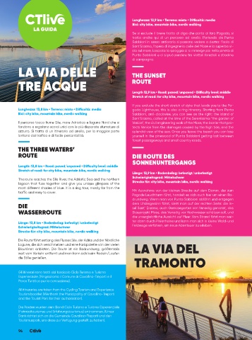
                                                              Se si esclude il breve tratto di diga che porta al faro Pagoda, si
                                                              tratta anche qui di un percorso ad anello. Partendo da Punta
                                                              Sabbioni in senso antiorario si possono vedere a destra: l’isola di
                                                              Sant’Erasmo, l’opera di ingegneria civile del Mose e la superba vi-
                                                              sta sul mare. Lasciata la spiaggia ci si immerge poi nella pineta di
                                                              Punta Sabbioni e ci si può perdere tra viottoli forestali e stradine
                                                              di campagna.
          LA VIA DELLE                                        THE SUNSET


          TRE ACQUE                                           ROUTE


                                                              Length 12,9 km • Road: paved/unpaved • Difficulty level: middle
                                                              Stretch of road: for city bike, mountain bike, nordic walking

                                                              If you exclude the short stretch of dyke that leads you to the Pa-
         Lunghezza: 13,8 km • Terreno: misto • Difficoltà: media  goda Lighthouse, this is also a ring itinerary. Starting from Punta
         Bici: city bike, mountain bike, nordic walking       Sabbioni, anti-clockwise, you can see on the right: the island of
                                                              Sant’Erasmo, called at the time of the Serenissima “the garden of
         Il percorso tocca fiume Sile, mare Adriatico e laguna Nord che si   Venice”, the civil engineering work of the Mose, the barrier that pro-
         fondono e regalano scorci unici con le più disparate sfumature di   tects Venice from the damages caused by the high tide, and the
         azzurro. Si tratta di un itinerario ad anello, per la maggior parte   splendid view of the sea. Once you leave the beach you can lose
         lontano dal traffico e di facile percorribilità.     yourself in the pinewood of Punta Sabbioni getting lost between
                                                              forest passageways and small country roads.
         THE THREE WATERS’
         ROUTE                                                DIE ROUTE DES
                                                              SONNENUNTERGANGS
          Length: 13,8 km • Road: paved/unpaved • Difficulty level: middle
          Stretch of road: for city bike, mountain bike, nordic walking
                                                              Länge: 12,9 km • Bodenbelag: befestigt/unbefestigt
                                                              Schwierigkeitsgrad: Mittelschwer
          The route reaches the Sile River, the Adriatic Sea and the northern
          lagoon  that  fuse  together  and  give  you  unique  glimpses  of  the   Strecke für: city bike, mountain bike, nordic walking
          most different shades of blue. It is a ring tour, mostly far from the
          traffic and easy to cover.                          Mit Ausnahme von der kleinen Strecke auf dem Damm, der zum
                                                              Pagode Leuchtturm führt, handelt es sich auch hier um einen Ra-
                                                              drundweg. Wenn man von Punta Sabbioni abfährt und entgegen
         DIE                                                  dem Uhrzeigersinn fährt, sieht man auf der rechten Seite: die In-
                                                              sel Sant’ Erasmo, auch Gemüsegarten von Venedig genannt, das
         WASSERROUTE                                          Stauprojekt Mose, das Venedig vor Hochwasser schützen soll, und
                                                              die unvergleichliche Aussicht auf Meer. Vom Strand fährt man wei-
                                                              ter dann durch Pinienhaine und kann man sich in kleine Wald-und
         Länge: 13,8 km • Bodenbelag: befestigt/unbefestigt
         Schwierigkeitsgrad: Mittelschwer                     Feldwege verfahren, um neue Abenteuer zu erleben.
         Strecke für: city bike, mountain bike, nordic walking
         Die Route fährt entlang des Flusses Sile, der Adria und der Nördliche
         Lagune, die sich verschmelzen und eine Farbpalette von der vielen
         Blautönen anbieten. Die Route ist ein Radrundweg, größtenteils   LA VIA DEL
         weit vom Verkehr entfernt und man kann sich beim Radeln/Laufen
                                                               TRAMONTO
         die Stille genießen.

          Gli itinerari sono tratti dal fascicolo Ciclo Turismo e Turismo
          Esperienziale. (Ringraziamo il Comune di Cavallino-Treporti e il
          Parco Turistico per la concessione).
          All itineraries are taken from the Cycling Tourism and Experience
          Tourism booklet (We thank the Municipality of Cavallino-Treporti
          and the Tourist Park for their authorisation).
          Die Routen wurden dem Band Ciclo Turismo e Turismo Esperienziale
          (Fahrradtourismus und Erfahrungstourismus) entnommen. (Unser
          Dank richtet sich an die Gemeinde Cavallino-Treporti und den
          Tourismuspark, uns diese zur Verfügung gestellt zu haben).

          94

